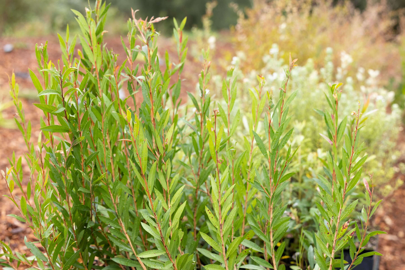
Technology may not be the first thing that comes to mind in the restoration of ecosystems. But having restored legally protected native forests for over 25 years, Greenfleet has seen technology evolve within the environmental sector and uses it to facilitate elements of our work.
As we investigate new ways to utilise technology in our revegetation projects, we are already using it to plan, plant, and monitor our forests. From using software to map our sites, to drones planting seed, and aerial imaging monitoring the progress of our projects, some technology is vital to the work we do.
Using Technology To Restore Native Forests
Technology helps facilitate our native reforestation work in many ways; overviews and planning, seeding and access, and the ongoing monitoring required to grow biodiverse forests.
With over 550 native forests growing in Australia and New Zealand, the use of satellite imagery helps us assess potential project sites and monitor existing projects as they establish. The planning for our revegetation projects begins a long time before the first tree is planted and systems like ArcGIS can scan the size and scope of a potential new project in the planning phase. This allows Greenfleet to assess specific requirements for the project and understand the potential environmental and climate action outcomes.
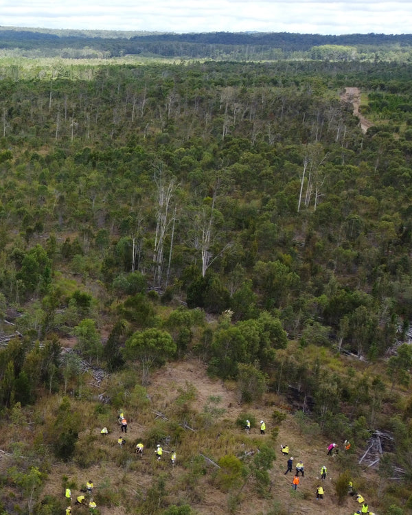
Greenfleet forests can be hundreds of hectares in size, meaning that most of our forests are in remote locations, with hills, valleys and bodies of water within the revegetation areas. In conjunction with on the ground monitoring and operations, technology helps us navigate these conditions. For example, by working with drones, Greenfleet is able to spread seed for regeneration across wide areas that are not accessible in vehicles or on foot.
Monitoring Our Forests
Greenfleet’s forests are legally protected for up to 100 years to ensure we are delivering long-term action through our projects. When we plant locally native species at our projects, it is only one step in the process of restoring resilient native ecosystems.
Once our forests are planted, we have a comprehensive monitoring schedule in place for the first five years of growth and utilise remote and on-the-ground monitoring throughout their lifetime. This gives us the opportunity to make any interventions required to ensure our forests are establishing well.
As our forests mature, the presence of native wildlife is one of the first signs that biodiversity is returning to these areas once cleared for farming. To understand this, we conduct biodiversity assessments to measure the impact of our work on local flora and fauna. These assessments include wildlife surveys, flora surveys, acoustic monitoring, soil micro biome and health assessments, nesting box monitoring and more.
By employing tools such as thermal imaging technology, we can track the movement of wildlife throughout the forest and highlight which areas have developed to support certain species. Greenfleet has also utilises drone imagery in conjunction with our groundwork as it enables us to efficiently assess and monitor our forests.
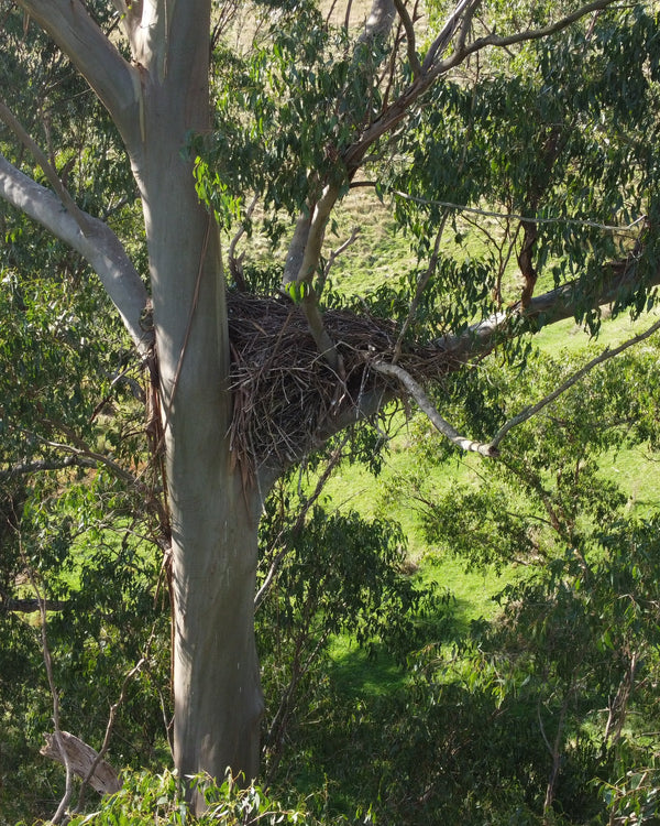
This wedge-tailed nest eagle (pictured) was discovered high in remnant vegetation in our Strzelecki Nature Link project in South Gippsland, Victoria. Images like this help us understand the existing wildlife in a region that will benefit from the habitat being extended through our work.
Environmental Outcomes Observed With Technology
Here are some more examples of how technology is an important tool in Greenfleet’s working growing, monitoring, and protecting our native forests:
ArcGIS
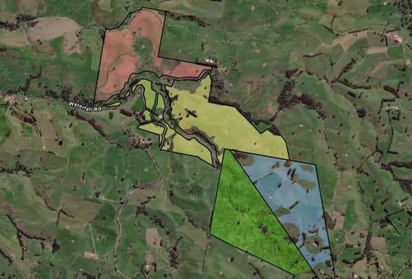
ArcGIS (Geographical Information Systems) is a sophisticated international satellite mapping system. It takes image patches that our dedicated GIS Officer can ‘stitch’ together to create the whole area at a glance. GIS shows elevation, steepness and geographical landmarks of our projects. It allows for detailed display and analysis of forest sites from conception to maturity, assisting our team with planning, forest monitoring and data collection, including drone mapping.
Pictured: The image featured shows Greenfleet's Strzelecki Nature Link, growing on Boonwurrung Country in South Gippsland. Using Arc GIS, each section is precisely mapped to enable detailed ongoing assessment of the four forests that make up the project.
Thermal Imaging
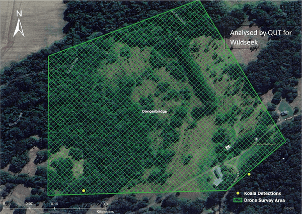
By planting biodiverse forests, we are restoring habitat for some of Australia’s most vulnerable species, including koalas. Thermal imaging can help locate species like koalas, that can be very difficult to locate from the ground. We can employ thermal imaging to ascertain if they are using the trees planted, and which areas are preferred. We follow up this assessment with on-the-ground site visits and scat analysis.
Pictured: These thermal images, taken at our Dangerbridge project on Kabi Kabi Country in Queensland, were captured by Noosa Landcare and analysed by Queensland University of Technology with AI. The two koalas identified are represented by the yellow dots.
Drone Seed Dispersal
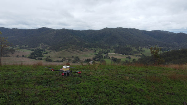
Aerial seeding using drones enables Greenfleet to revegetate difficult to reach areas of our forests. They are also invaluable where we are spreading seeds across large distances. The seed ‘bombs’ are formed by hand, then dropped into hard-to-reach areas using drones. For example, drones may be utilised to plant seeds after an ecological cool burn event has occurred.
Pictured: Our Cherry Avon forest is one for four properties making up Greenfleet’s Ivory Creek project on Yuggera Country, Queensland. This image shows the site receiving a delivery of seed ‘bombs’ after a prescribed ecological burn. These perishable seeds were germinated with fire then dropped onto the forest ash bed, which they require to take root.
Drone Photography
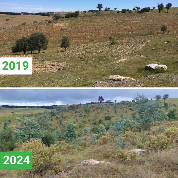
Drone photography is one of the most effective methods to gain wide-view aerial images of Greenfleet’s forests. We use this technology regularly to create comparisons as the forest grows. We can also use drone footage to monitor weeds and review the site for potential additional plantings. Our team relies on drone imagery to complement our monitoring processes as it allows us to view areas that can take hours to traverse on foot or by vehicle.
Pictured: Located on the lands of the Dharug people in Limerick, NSW, Greenfleet first planted at Turkey Hill in 2019. This drone shot was taken by our Revegetation Team in 2024, showing impressive growth in less than five years. The trees at Turkey Hill are creating shelterbelts to protect grazing animals and restore parts of this mostly barren landscape back to native forest.
In our work restoring legally protected native forests, technology plays an important role in the way we grow and monitor our projects. By using these innovative technologies, we enhance our forest monitoring processes, can employ best-practice land management, and increase our understanding of the wildlife utilising our forests.
Technology helps us grow our forests, restore nature, and grow climate hope.


